August 20, 2009

The Baby Burrito

Newborn babies have a tendency to unintentionally flail their arms about, which can agitate them, which can cause them to flail further, which can agitate them further, and so on.

One heck of a yawn

The easiest way to calm them down is to swaddle them. If, like me 10 days ago, you're wondering what the hell that means, think of it like this: wrap them up like a burrito. With the baby's arms held closely by their side the flailing never starts. Baby will remain calm (unless, of course, there's something else wrong...).

I picked up the technique rather quickly from the nurses at the hospital after William was born.

  • Find a soft, flat surface like a bed or couch.
  • Lay the swaddling blanket (apparently this is a standard sized thing) in the shape of a diamond on the flat surface.
  • Fold the top of the diamond down a little ways (the exact amount is not important).
  • Lay the baby on the blanket so the top (folded) edge is behind the baby's neck, above the shoulders.
  • Pull the baby's arms down to his/her side and hold them there. The baby will resist, but you can easily overpower a newborn. I find it easiest to hold both arms down with one hand so the other hand is free to fold the blanket, but your hand-size-to-baby-size ratio may be smaller than mine. In that case just hold one arm down at a time and use the blanket to hold the first arm down while you move the second arm into place.
  • Fold the left corner of the blanket tightly across the baby's chest, over both arms, and tuck it in just a little bit on the right side of the baby (your right side, baby's left side).
  • While still holding the baby's arms down (they could still get loose at this point), fold the bottom corner of the blanket up over the baby's legs and torso.
  • While still holding the baby's arms down (they could still get loose at this point), lift the right corner up in the air at about a 45˚ angle and cinch it nice and tight. The tighter you cinch it, the less likely the baby will wiggle his/her way out of the burrito. Just don't hurt the baby.
  • Finish folding the right corner around the left side of the baby (your left side, baby's right side).
  • Lift the baby slightly and continue to fold the remaining slack under the baby.
  • At this point the baby should calm down rather quickly.

    All swaddled up

August 17, 2009

The Look

Things have been hectic these past six days, but Melissa, William, and I are managing okay (with an awful lot of help from Melissa's mother). Fig William has settled into a routine of eating, sleeping, pooping, and making funny faces (with the last two often done in conjunction). He had some real doozies today.

He's got the look.

He's got the look

One eyebrow raised? Come on, that's my look.

The look

Incidentally, I've posted a number of pictures to my Flickr stream that have not and/or will not make it to the blog. So if you really can't get enough of William (Grandmas, I'm looking at you) you can check my Flickr stream on a regular basis... or better yet, subscribe to the RSS feed.

August 13, 2009

The Birth Day

This kid sucks. I mean that literally, of course. William is a sucker. He will suck on anything near his mouth, he will suck hard, and he will not stop sucking. His favorite thing to suck is his entire fist.

We got around 2-2.5 hours of sleep (spaced out over three naps) after William was born in the wee hours of the morning yesterday. We had a few people come to visit. We received plenty of phone calls and emails from our wonderful friends and relatives. Thank you all so much for your kind words and support. The consensus seems to be that he will go by Will (or possibly Guillermo en EspaƱol).

We will go home tomorrow morning. It will be a nice birthday present for Melissa. Until then it's likely to be more eating, sleeping, sucking, and pooping... more for some of us than others.

Grandma Nancy
Grandma Nancy

Grandma and Grandpa Raguet

Will sleeps
Will sleeping

William & Mom rest
Will and Mom

John & Cara with William
friends John & Cara

John practices his footbal hold
John practices his football hold

Grandpa and Grandma Schofield

Grandma Barb with William
Grandma Barb

Rob & William
Daddy & Will

Team Ragfield
Team Ragfield

August 12, 2009

The Boy

Melissa went into labor yesterday, three days before her 30th birthday, about 10 days prior to her due date. We went to the hospital mid-afternoon. At 1:19 AM this morning (August 12, 2009) William Miles "Fig" Raguet-Schofield came into this world, waterlogged and tender. Melissa and William are both doing fine.

I am utterly exhausted after merely assisting with a day-long labor. I can't even imagine how Melissa must feel. She's one tough cookie. I can only assume the boy will be just as tough.

William & Melissa

Waterlogged and tender

Rob & William
Note that Fig's hair is longer than mine

Fig

Feet

August 11, 2009

The Highest Point in North Carolina

A few days after riding Clingman's Dome (the highest point in Tennessee) I rode Mt. Mitchell (the highest point in North Carolina). That was four years ago today. The bulk of the climb was quite similar to Clingman's Dome: not very steep, winding roads, not much traffic. However, Mt. Mitchell threw in a few surprises that made it quite a bit more challenging.

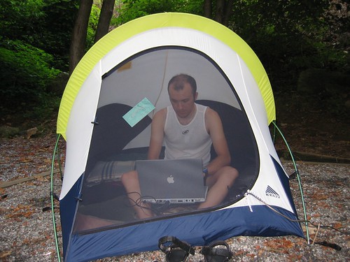
Rob computing

Just outside of Asheville, NC we turned onto the fabled Blue Ridge Parkway. This is a 500 mile scenic drive (no commercial traffic allowed) through east-central Appalachia. Once again, I rode my trusty Thundercougarfalconbird, while Melissa drove Iris the support vehicle. The road turned upward immediately as I rode away from Asheville.

Blue Ridge Parkway

The first few hours (yes, hours) went smoothly. This part of the climb was not very steep. I settled into a steady pace. This climb (35 miles) was much longer than the two other mountains I had previously ridden, Clingman's dome (20 miles), and Mt. Tam (10 miles). To put it in comparison, it dwarfs the climbs typically done in professional bike races (where 10 miles is a long climb, and virtually no climbs are longer than 12-15 miles). Of course, it wasn't that steep though. Yet.

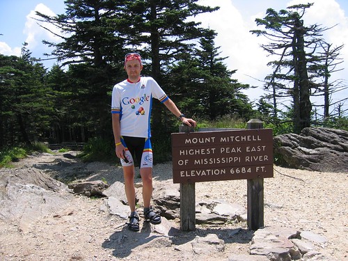
Mt. Mitchell

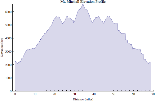
Around 5,000 ft altitude I noticed for the first time it was actually much more difficult to breathe. Around 5,500 ft I encountered a fairly long downhill section which caused me more worry than relief. Every inch I descended would be another inch I would have to climb again to reach the top. Before long the road went up again. Then back down again. Crap.

Mt. Mitchell

Finally, I reached the turn off of the Blue Ridge Parkway into Mt. Mitchell state park. This is where things got interesting. The road immediately hit 9% and stayed that way for 1.5 miles or so. After hours of climbing a moderate grade, this steep section really hurt. Fortunately, the top was very near, and I made it without incident.

Mt. Mitchell

Mt. Mitchell

After a brief rest at the top came the fun part: 35 miles downhill (well, except for those two stupid dips which I had to ride up on the way back).

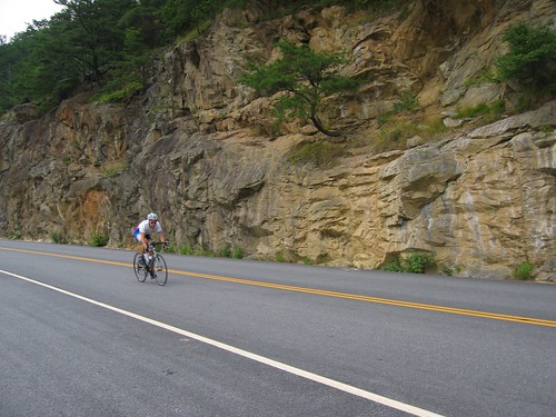
Mt. Mitchell descent

At one point I noticed a few cars backed up in the road, so I had to slow down. I wondered what was going on. There was nothing blocking the road so I gently eased around the stopped cars and continued on my way. As soon as I reached the front of the group I looked over to my right and noticed about 20 meters away from me was a bear walking along the side of the road. I coasted along as I stared at it, not believing my eyes. I was used to seeing dogs while cycling, maybe even deer, but this was a first for me. Anyway, I quickly came to my senses and hauled ass out of there. I had no desire to become this bear's lunch.

Mt. Mitchell map

Mt Mitchell profile

Ride Information
Date:2005-08-11 8:50 AM EDT
Mountain:Mt. Mitchell
Road Elevation:6585 feet
Climb Distance:34.25 miles
Climb Ascent:5956 feet
Climb Average Grade:4.3%
Climb Maximum Grade:9%
Ride Distance:69.9 miles
Ride Total Ascent:7472 feet
Ride Maximum Speed:48 miles/hour
Ride Start:Asheville, NC (2194 feet)
Ride End:Asheville, NC (2194 feet)

August 8, 2009

The Highest Point in Tennessee

I enjoy cycling. Long time readers might recall that a long term goal of mine is to cycle to the highest point (well, highest paved road) in every U.S. state. The first one I checked off the list was Tennessee, four years ago today.

Living most of my life in flat, flat central Illinois I have a special appreciation for mountains. The first mountain I rode was Mt. Tam in California, in 2004. I rode it again in 2005, at which point I was hooked. I needed more mountains, but I had none near home. So I started looking around for places where I could take trips to ride mountains.

Having spent every summer during college working in central Appalachia I was somewhat familiar with this mountain range, plus it's an easy day's drive to get there. But where to go. If I was going to take a special trip I wanted some big, big mountains. The two biggest are Mt. Mitchell (6,684 feet, the highest point in North Carolina, near Asheville, also the highest point east of the Mississippi river), and nearby Clingman's Dome (6,643 feet, on the TN/NC border, the highest point in Tennessee).

Iris packed for vacation

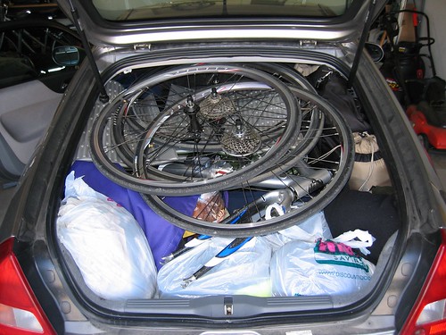
What started out as kind of pie-in-the-sky wishful thinking quickly turned into a week-long family vacation in August 2005 (i.e. best vacation ever®). We packed the Insight full of camping gear, food, clothes, and two (yes, two) bikes and headed to the Great Smoky Mountains National Park.

Camping at Great Smoky Mountains National Park

We camped in the park (just outside of Gatlinburg, TN) the first night and woke up bright and early, ready to tackle Clingman's Dome: me on the bike, my wonderful wife driving the support vehicle. The ascent was 20 miles long and rose around 5,000 ft. The road wasn't terribly steep (4-5%) since it was in the national park and it was built so RV's could make it up.

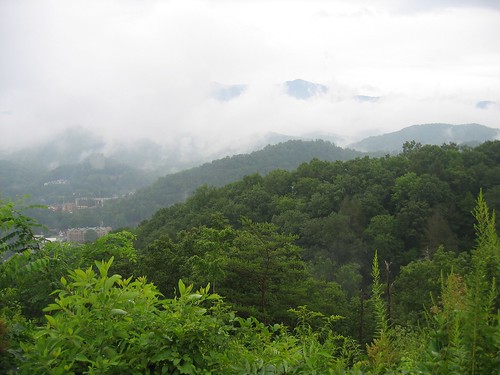
View of Gatlinburg, TN

The first mile or two was very easy. I was cruising along at 16-17 mph thinking this will be a piece of cake. The gradient increased gradually until I was closer to 8-10 mph, where I would remain for most of the climb. I didn't know what to expect with such a long climb (twice as long as the only other mountain I had climbed), and since I have a double chainring I switched to a mountain bike cassette with a 32-tooth cog before the ride. I could have gotten by comfortably with a 28. My regular road cassette only had a 25. This would have been usable, but much more difficult.

Clingman's dome

The first 12.5 miles on Newfound Gap Road had just a little bit of traffic, but it wasn't bad. All the cars were going very slowly anyway, so my presence didn't seem to cause any problems.

Newfound Gap

At Newfound Gap I stopped to get new water bottles from Melissa, then turned off onto Clingman's Dome Road for the final 7.5 miles. There was very little traffic on this road. Aside from a short downhill this road was also a little bit steeper.

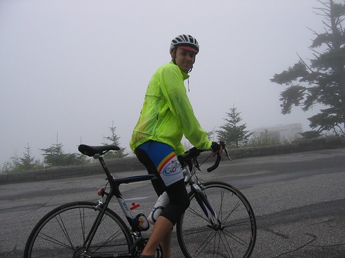
Rob at top of Clingman's Dome

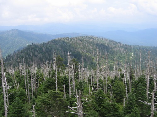
What had been foggy and overcast weather all morning turned into a light drizzle at the summit of Clingman's Dome. Fortunately, we made another trip back there a few days later for a better view from the observation tower at the top.

View from Clingman's Dome

Appalachian Trail at Clingman's Dome

I chose to descend the other side of the mountain, into North Carolina, rather than go back down the way I came up. Like the other side, this side wasn't terribly steep, but it did have some long straight sections that relatively safely allowed for high speeds.

Rob on Clingman's Dome descent

This was only the third time I had ridden a mountain, so my descending skills were a little lacking. Nonetheless I was able to get up to 48 mph or so on the descent.

Clingman's Dome descent

At the bottom Melissa picked me up and we drove off to the next campground where we would continue our great adventure. I really enjoyed the ride up to and back down from Clingman's Dome. It was challenging, but not ridiculous (like Mauna Kea). It was a good warmup for Mt. Mitchell a few days later.

Clingmans Dome map

Clingmans Dome  profile
I had some GPS wonkiness that caused the square looking sections

Ride Information
Date:2005-08-08 7:39 AM EDT
Mountain:Clingman's Dome
Road Elevation:6318 feet
Climb Distance:20.0 miles
Climb Ascent:4837 feet
Climb Average Grade:4.8%
Climb Maximum Grade:?
Ride Distance:50.6 miles
Ride Total Ascent:5895 feet
Ride Maximum Speed:48 miles/hour
Ride Start:Elkmont Campground, GSMNP, TN (2285 feet)
Ride End:Oconaluftee Vistior Center, GSMNP, NC (2046 feet)

A I mentioned, we came back to Clingman's dome a few days later and parked at Newfound Gap. From there Melissa & I rode together the last 7.5 miles to the top. Despite her fear, I think she really enjoyed the ride. Conquering that mountain was certainly difficult for her. She often mentions that experience in the same breath as other difficult moments in her life (i.e. marathon #1, marathon #2, marathon #3, etc.) that have helped her learn to persevere.

August 1, 2009

The End of July

See previous post for summary.
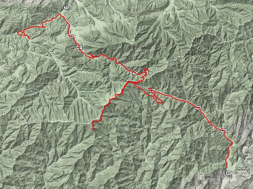
Photo of the Day

July 2009 Photo of the Day

Running

(intentionally blank)

Cycling

New kit

July 2009

BikeDistance# RidesAvg per Ride
Bianchi40.3 Mile85.0375 Mile
Thundercougarfalconbird166.44 Mile441.61 Mile
Total206.74 Mile1217.2283 Mile

January - July 2009

BikeDistance# RidesAvg per Ride
Bianchi394.9 Mile864.59186 Mile
Big Red12.07 Mile43.0175 Mile
El Fuego54.42 Mile77.77429 Mile
Pocket Rocket201.17 Mile296.9369 Mile
Thundercougarfalconbird1257.06 Mile3140.5503 Mile
Total1919.62 Mile15712.2269 Mile

Swimming

Riverboat

MonthDistance# WorkoutsAvg per Workout
January1.87452 Kilo Meter30.62484 Kilo Meter
February14.9504 Kilo Meter62.49174 Kilo Meter
March19.5224 Kilo Meter72.78892 Kilo Meter
April13.3502 Kilo Meter62.22504 Kilo Meter
May12.7806 Kilo Meter71.82579 Kilo Meter
June17.15 Kilo Meter82.14375 Kilo Meter
July15.55 Kilo Meter62.59167 Kilo Meter
Total95.1782 Kilo Meter432.21345 Kilo Meter

Walking

Angle

MonthDistance# WorkoutsAvg per Workout
July29.52 Mile102.952 Mile

Scooter

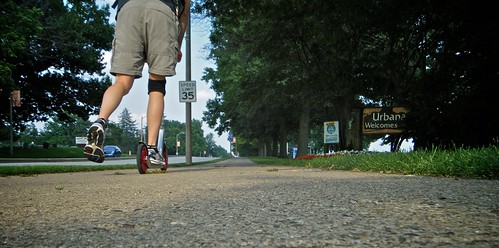
Urbana welcomes you

MonthDistance# WorkoutsAvg per Workout
July13.4 Mile43.35 Mile