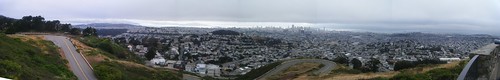
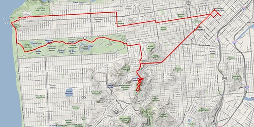
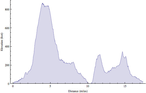
On my 6 a.m. bike ride this morning I headed towards Golden Gate park. When I reached Market & Castro the "bike route" split off from Market up this hill, so I continued up the hill. I reached the top at an intersection. To the left it continued to go up, so I turned left. A few turns later, after a mile and a half climbing at 10% gradient, I found myself at the top of Twin Peaks (nearly the highest point in the city). Even though the air was hazy the view was spectacular.
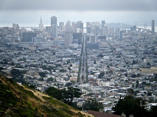
You can see this hill from anywhere in the city, but for some reason I always assumed the top wasn't publicly accessible so I never tried to ride up before.
After descending the hill I rode through Haight-Ashbury, Golden Gate Park, along the Pacific coast, then back downtown.

3 comments:
AWESOME < AWESOME PHOTOS!!!!!!!! Thanks for taking me along on the ride.... spectacular views of the city!!!!! Stay safe and upright!!!! Hugs, nan
no wonder you were pale and perspiring when you got back.
GOOD HEAVENS, SON...
Is this by any chance one of your "goals" to visit the high point in every state?
Your pictures are beyond awesome!
Mom
Post a Comment